Philadelphia west, via Erie and Lehigh Valley " route. : In effect July, 1876
View
@ Huntington Library
Erie Railway, publisher
Description
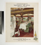
Image of three maps related to railroad routes of the Erie Railway: a map in the upper left corner of the northeastern United States with railroad lines between New York City and the Great Lakes region; a map of Western Europe with steamship lines in the upper left; and a map of New York City in the lower left corner, with timetables and promotional descriptions on both the recto and verso; map verso also includes three vignettes of three ornately decorated interiors of a Pullman sleeping car, a dining car with well-dressed diners and African American waiters, and a drawing room car; fold-up map.Probable date based on item title. "Published by Erie Railway Company and Entered in the Office of the Librarian of Congress at Washington 1874"--text, bottom left of New York City Map. "New York / Up Town or Down Town!"--text, title of map, upper left corner. "A map of the city of New York showing the location of the Freight and Passenger Stations, Ferries, Street Car Lines, Offices, Terminal facilities & Connections of the Erie Railway with the Ocean Steamship Lines."--text, title of map, lower left.
Image
Last, Jay T., donor
For information on using Huntington Library materials, please see Reproductions of Huntington Library Holdings: https://www.huntington.org/library-rights-permissions


