Description
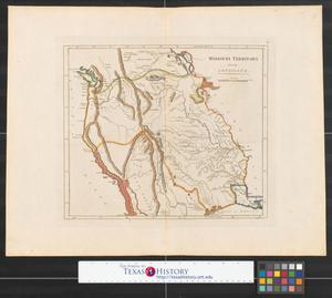
Engraved map of Louisiana, showing lakes, rivers, towns, forts, and a few roads.Map is identical in all but coloring to plate 26 in Carey's General Atlas, 1814 edition. For more information see Ristow, Walter W., "Early American Atlases and Their Publishers" in "Images of the World Atlas through History," ed. John A. Wolter, 1996. The number "26" is written in the upper right corner of this map. Map published in Philadelphia.November 2007TIFF displayed as JPEG 2000Map
17 X 21.5 In.
Reproduction (printing, downloading, or copying) of images from Kansas City Public Library requires permission and payment for the following uses, whether digital or print: publication; reproduction of multiple copies; personal, non-educational purposes; and advertising or commercial purposes. Please order prints or digital files and pay use fees through this website. All images must be properly credited to: "Missouri Valley Special Collections, Kansas City Public Library, Kansas City, Missouri." Images and texts may be reproduced without prior permission only for purposes of temporary, private study, scholarship, or research. Those using these images and texts assume all responsibility for questions of copyright and privacy that may arise.


